Hello everyone,
News – and a question has come up for me that I cannot explain on my own – it would be great if you planning experts could explain the following to me:
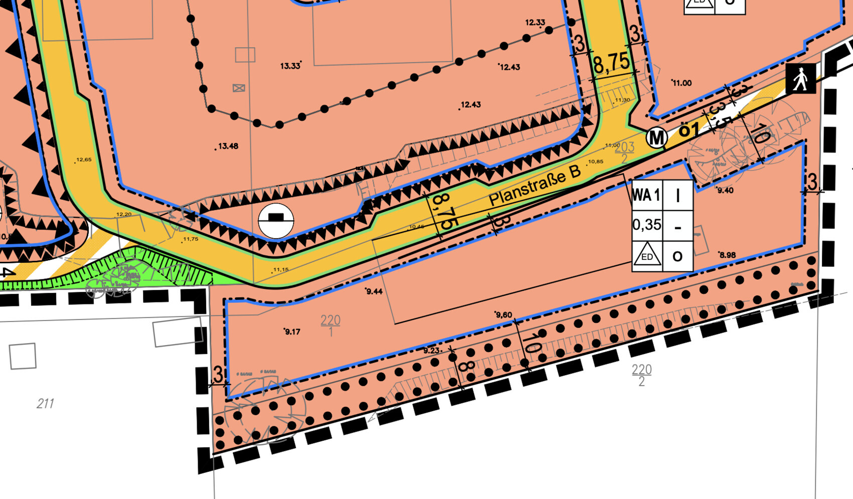
Above the "Planstraße B" there are these outward jagged lines. The light gray lines below show an embankment currently present on the site. According to the explanation, the jagged area means:
"On the areas for embankments, the surface of the plots is to be adjusted by filling to the heights of the adjacent traffic areas."
Filling. So they want to embank here – which makes sense. However, I do not understand "height of the adjacent traffic areas"?! According to the image, the ground on the upper part of the street is currently 12-13 meters high – then comes the street – and below that "my" plot – currently 9.40 to 9.60 meters in height.
Does that mean the street will be set higher? Only then would the plots north of the street have a filling relative to the adjacent traffic area, right? Would my driveway then be quite steep upwards to the street? ;)
I hope you understand what I mean... so my plot lies significantly lower than the street that will be created there? And if yes, is that at least an advantage for me regarding the permissible eaves height? This is defined as follows:
"Maximum 4.50 meters – the reference point for the heights of structures is the height of the finished, developed traffic area adjacent to the plot (top edge of the traffic area OVF according to the plan drawing), each in the middle of the plot access."
Or am I completely misunderstanding all this?
Viebrockhaus has also commented again with more precise prices for my basement – more on that later, I have to review it calmly first.
Thanks in advance!
