Yes, it does. It is also explained that way in the legend (Weilheim 174 east of Prälatenweg II); the ridge direction is binding.
You really took the trouble to read the development plan? Thank you very much!
From my point of view, without excluding any of the desired options; the garages can probably be placed in the blue building area or in their special zones.
For comparison, I looked at other development plans of our city. There, the possible areas for garages, carports, and parking spaces are always outlined in red and—according to the text—specified. I also understand this development plan to mean that garages can be placed in the blue building area and, for some plots, additionally in the special zones.
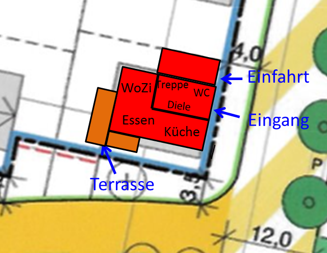
What is the separated rectangle ("top left") in the building footprint supposed to mean?
I wanted to indicate the classic "L" for cooking/eating/living in the house. In variant 2, however, I forgot to change it. I have attached it again for clarification.
Thank you very much for your opinions so far. I see that variant 2 is the favorite so far. The problem with bicycles, garbage bins, etc., remains. Is a garage with an interior width of 3.5 m sufficient to get past the car with a bicycle? A garage on the boundary is allowed to be up to 9 m long, right?