majuhenema
2019-09-29 19:42:36
- #1
Dear house building forum,
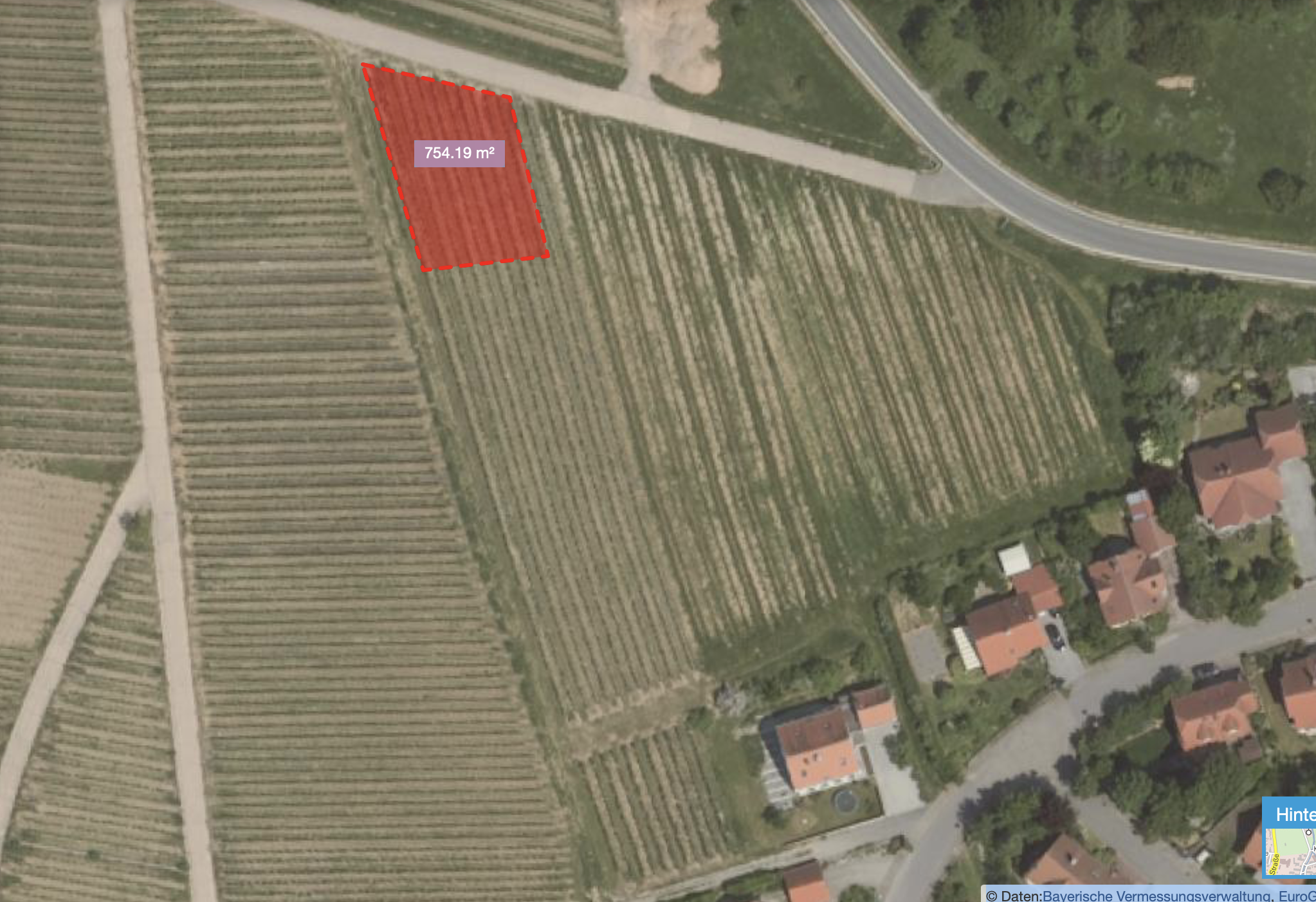
we are still quite at the beginning. The planned development area of our municipality includes 9 building plots and is currently at an early stage. An initial draft from the urban planner has been submitted to the municipality. For illustration, I have attached an amateur screenshot of the BayernAtlas. I am hoping for feedback from more experienced eyes. We had to decide quite quickly and all other plots are already reserved. So the focus should primarily be on "our" plot and not on the possibilities of the others. I would like to thank you in advance for this.
Explanation:
- To the northeast runs the district road, around the development area Betonstraße or field path.
- The access should be either via the district road or via the bottom left. In both cases, we would have access through the turnaround in the middle, without a direct road connection, but possibly with a driveway (lower corner downwards to the turnaround).
We have registered for the corner plot.
Reasons for this:
- All plots attractive to us have a slope; "our" plot is the highest.
- Access to nature from two sides.
About the plot itself:
- Plot size approximately 750 m2 as shown.
- Highest point top left (236.5m), point bottom left (233.0m), (230.3m) top right (232.5m).
The plot slopes diagonally by about 6m.
- North is already at the top on the screenshot, so it should be a southeast slope (?)
My questions:
1. How critical do you consider the slope, especially considering that it runs diagonally across the plot?
2. How would you position the house (difficult without a building window at this stage, I know) in view of the cardinal directions and the access (from corner bottom right south to the turnaround)?
3. What have I forgotten to mention?
Thanks again in advance!