maduuto
2019-08-15 03:17:38
- #1
Hello. We are getting a plot of land in a new housing development. Now we don’t quite understand the whole topic of land filling etc. What is allowed, what should be done?
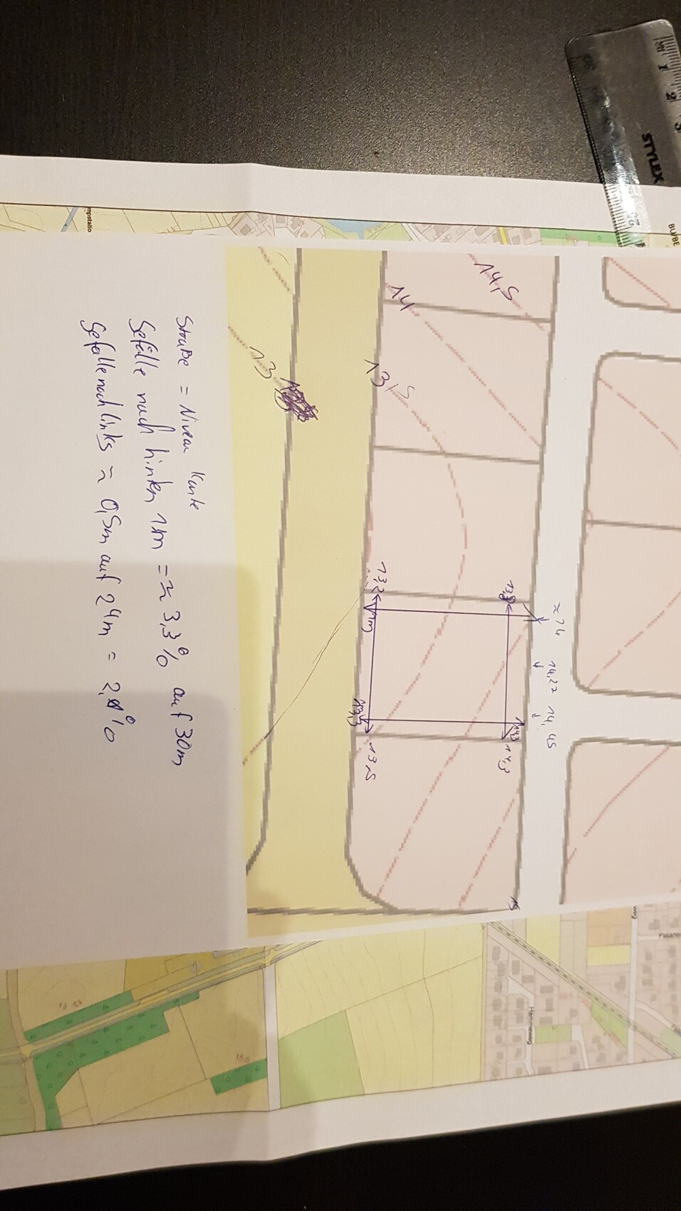
Our plot is 24m wide and 30m long. The planned road on the north side (along the 24m) will have roughly the same height level as the plot, at least that is what I can deduce from the topographic maps and the planning measurements of the road.
According to calculations, the plot has a slope of one meter over 30m in length to the back, which is about a 3.3% slope. On the 24m width, the ground on the left is about 0.5m lower than on the right, which is about a 2.1% slope across the entire width.
The house will probably have the finished floor edge about 30cm above street level.
Now my questions:
Assuming I do not change the terrain level, the rainwater can flow off to the back, which is not a problem, but it also flows off to the left towards the neighbor, do I need to do anything about that?
Assuming I raise the terrain on the left so that it is as high as on the right, only the slope to the back remains, and I raise the ground from the house to the street so that the rainwater flows away from the house to the front and back - what do I have to consider? Will the increase be so high that I have to catch something? I am currently thinking that the lateral 50cm is quite a lot, if the neighbor doesn’t also happen to raise their ground. What is generally allowed?
Oh, we don’t really know how to design something like this, where can we get help? I have sent an excerpt from the topographic map. Maybe it’s not that complicated after all. How would you do it? Can you give me tips based on the map? Looking at it, the terrain level compared to the neighbors seems relatively even, right?
On the left, the elevation lines are marked. The plot where the lines are drawn is ours. Can you help? If this is the wrong area please say so, then I will create the post differently. Many thanks