wobbbel
2023-02-28 21:53:53
- #1
Hello everyone,
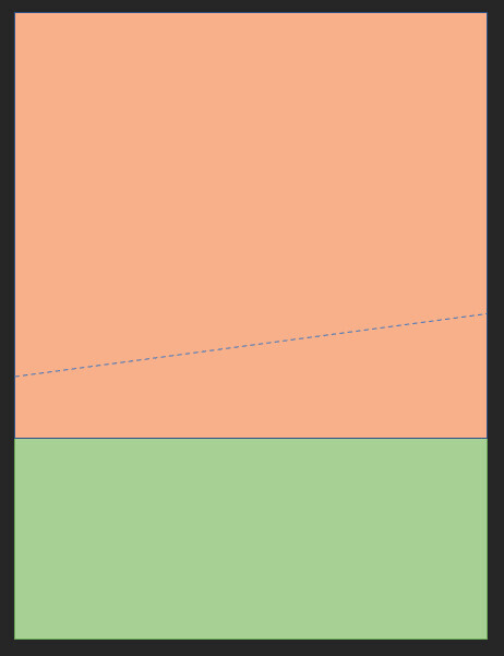
I own an area of about 20,000 sqm on the outskirts of a small town in eastern Germany. The area consists of a smaller garden plot/pasture (green) and a community garden complex (orange) (see graphic below). The lower part of the area is designated as land expected to be developed in the land use plan. In the illustration, this would be the part below the dashed line.
Now I have a prospective buyer who wants to purchase and develop this land expected to be developed. Therefore, the big question now is exactly where the boundary of the land expected to be developed runs.
Of course, you can agree on an area value in the purchase contract and after the survey is completed, any overpaid or underpaid amount can be balanced out. That would be no problem. But for me, the exact boundary is relevant for two reasons:
First, some leased plots in the community garden complex may have to be cleared or relocated. (There is consensus with the association, the complex is mostly vacant).
And second, I of course have an interest in selling as much as possible. So to move the boundary upwards as far as possible.
Although the land use plan of the city shows both the building land and the land expected to be developed, the map is quite rough, and even the line thickness (dashed line in the second illustration) is practically several meters thick in reality. And as far as I know, the land use plan is more intended as a guideline and does not show the exact boundaries precisely, right?
Therefore, I am turning to you in the hope of finding someone who knows how this usually works. Who ultimately decides exactly how far the future building area may extend? Can I already find this out at this point in time so that I can proceed with the termination/relocation of the garden plots?
I am grateful for any help!! Best regards!